📣 Africa Map Raid is LIVE - Feb 16 - Mar 2, 2025

And what an amazing ride it’s been! Thank you to yourself and the raid organisers for this great raid!

This raid managed to catapult me from about 18,000 edits to 60,000, in the process surpassing L3 & the 50,000 edit milestone. I would love to do this again with a different part of Africa. :smile:

10 Likes

Congrats @DeviateFromThePlan !! That’s a massive increase :slight_smile:

1 Like

Congratulations Edward, keep on going.
Your signature is awesome, can you give me a tip to improve mine please?

1 Like

Greetings to all, especially Team Ox (Somalia).
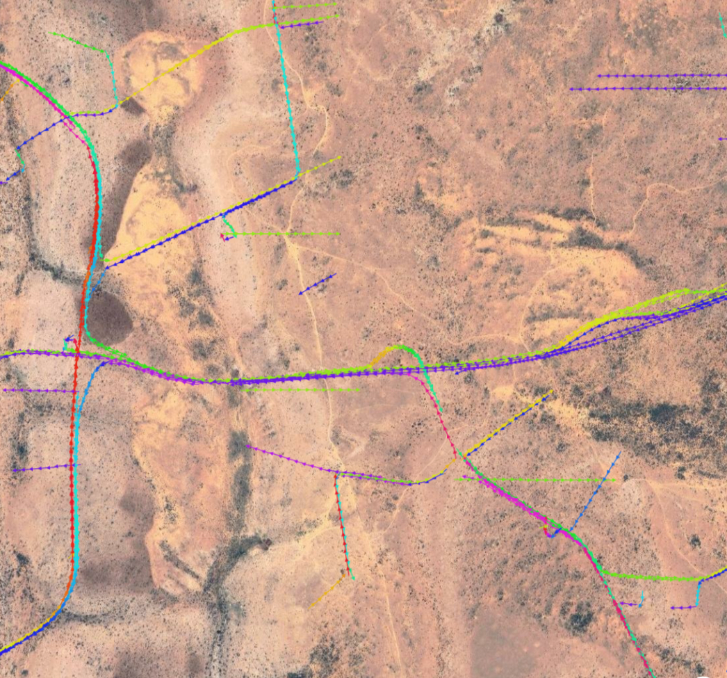
I wanted to show you something curious by visiting the following permalink:
https://waze.com/es/editor?env=row&lat=9.99943&lon=50.87921&marker=true&s=4703919892833942765566&zoomLevel=16
At zoom 16 or higher and with the GPS tracks layer active you can see some pronounced GPS tracks that can’t be correct, in fact they continue in the sea.
In case any action should be taken.
Thanks for everything.
Rotixxx

1 Like

This was my first raid and it was amazing. And I even became a level 4 editor! I hope to participate in others! Waiting for the ranking announcement! (Ox Team)

2 Likes

Excellent job, especially team crocodile!!! Is was an exciting work finding cities and mapping the areas. Thanks to all.

5 Likes

It has been an incredible MapRaid and a fantastic experience! I hope we get to do it again soon. :smile:

3 Likes

It was a very nice experience to be part of this Raid, my first one.
The girafa´s team area was a very hard area to find roads, differ them from other elements in the map, and no cities, I think it could not be called villages what I saw. But was totaly diferent from what I use to see daily!
Thanks guys,
Paulo

3 Likes

This is very strange!

It also started off very well here, but then it became very difficult to continue because there was no area. Near the areas where I had visibility I found many opportunities, but without permission.

I would like to thank you for the opportunity. Great times at MapRaid these past few months. Thanks to everyone for the help and support.

Probably someone using waze inside an aircraft.

Greetings @FPereira_84.
It could be an explanation, but it seems to me very difficult for aircraft to confluence and make shapes like traffic roundabout.
I share another area somewhat further south with this type of shapes:
https://waze.com/es/editor?env=row&lat=9.93819&lon=50.72213&marker=true&zoomLevel=16

If it’s an helicopter, it isn’t that difficult. I followed some tracks, and they came from the ocean.

My browser stopped updating, but maybe you can see.

https://waze.com/pt-PT/editor?env=row&lat=9.89208&lon=51.27416&marker=true&zoomLevel=16

3 Likes

Definitely looks like some kind of error. Those are clearly highway interchanges in the GPS tracks to the southwest of your permalink.

3 Likes

Totally agree and that’s why I shared it here.
Greetings.

1 Like

It has been an incredible MapRaid and a fantastic experience!

1 Like

Greetings to all.
What is the way to get the “Map Raid” forum medal?

4 Likes

Greetings to you all, congratulations to all the teams for the great effort.

3 Likes